KINGSTON, Mar. 27 (JIS)
The Jamaica Civil Aviation Authority (JCAA) is nearing the completion of its comprehensive modernisation programme to upgrade and replace major components of its Communications, Navigation and Surveillance systems.
JCAA Director General, Nari Williams Singh, tells JIS News that the upgrades will allow the authority to satisfy international requirements and to remain apace with improvements to technology in aviation.
“As the air traffic increases, all Flight Information Regions (FIR), including Jamaica, have to respond because you want to be able to move aircraft through your airspace more efficiently,” Mr. Williams Singh says.
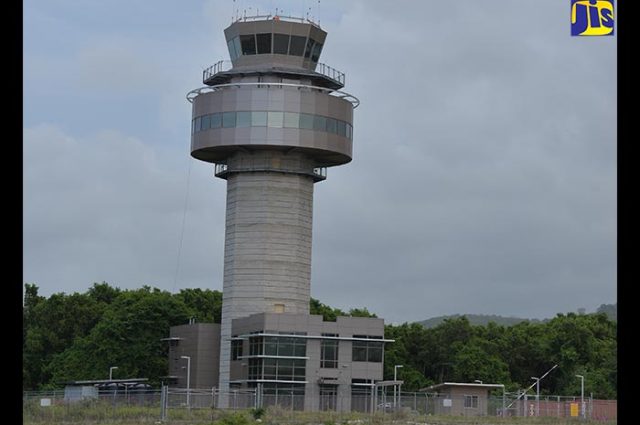
“The new technologies provide for that. You can improve your efficiencies, your accuracy and your reliability. You also have to balance that with environmental factors and cost factors, so aircraft are looking for the most direct route to get from one point to another,” he adds. A new air traffic control tower was formally commissioned at the Norman Manley International Airport in November 2016. The new air traffic control tower at the Sangster International Airport is to be commissioned in April.
Also, an instrument landing system has been installed and commissioned at the Sangster International Airport, which assists pilots to navigate and land in bad weather.
A Project Manager for the Air Navigation Modernisation Programme was hired through the International Civil Aviation Organization (ICAO) Technical Corporation Bureau (TCB), which facilitates assistance in providing technical expertise to contracting states.
In addition, all radars were upgraded and the automation system was installed during 2017 and technical training done.
For his part, Deputy Director General, Air Navigation Services at the JCAA, Carl Gaynair, notes that there is a move to reduce carbon emissions within the airspace by aligning the routes to more direct flight paths from airport to airport.
“We are… changing from ground-based to a satellite-based system so we can reduce the time that these aircraft will travel and, by so doing, reduce our carbon emissions. This is a major factor in what we do towards climate change because aircraft operate closer to the ionosphere so they have a more direct effect on it,” he says. He explains that the legacy system uses VHF Omnidirectional Range (VOR) which is in very high frequency. “Each airport has a VOR that has different frequencies. A pilot would select their frequency for the particular airport that he/she is going to and the instrument will point to the airport so the pilot can know how far the aircraft is from the airport. Because of that, the air routes were based on VORs and airports are located all over so the routes would take a zigzag pattern,” Mr. Gaynair states.
“However, when you use the satellite-based system, you can have a direct route and reduced flying time and distance, so you reduce the fuel. From that fuel reduction, you can calculate the carbon emission that you have reduced to assist with climate change,” he adds.
He points out that this is a worldwide move and, as such, Jamaica has to be on board.
Another major upgrade is the implementation of the Aeronautical Information Service (AIS). Mr. Gaynair tells JIS News that the equipment was procured and approval was granted to train and employ 12 new persons to operate that system.
“We are also doing the procedures to implement that system which is a network of all airline and airport operators and air traffic control divisions,” he states.
Meanwhile, the Deputy Director General further informs that the implementation of a Performance Based Navigation (PBN) system is imminent and will require retooling of aircraft because new satellite-based equipment will have to be purchased. “The current system that we use is land-based so the aircraft will be outfitted with equipment that can read the VOR signal and the air traffic controllers would have similar equipment. Satellite systems are more cost effective to purchase and maintain,” Mr. Gaynair explains.
He notes that a route that is based on a VOR is 100 miles wide, while PBN routes can be 15 miles either side or as little as 10 miles depending on the accuracy of the equipment on board the aircraft. “The system will warn the pilot in flight to maintain the direct route if the aircraft veers too far left or right. This will facilitate more routes within an airspace and will also facilitate parallel routes with several routes going in one direction,” he states. Meanwhile, Mr. Williams-Singh notes that the Government has been supportive of the authority through the various stages of technology upgrades.
“Successive Governments have realised the tremendous importance of air transport to our island and so there has been a support for ensuring that we meet international standards. Once we can provide all the justifications and the technical information, the support is there,” he says.
He adds that “it bodes very well when we are assessed by international organisations because that is one of the things they look at as well, the type of support. They ask if we have the necessary resources and processes in place to support what we are doing”.
